Poster Maps
I know I have talked about the poster maps for The City of Great Lunden a little bit, but I have now created a couple of 3D mock-ups to help explain it better.
This has so far been a colossal undertaking.
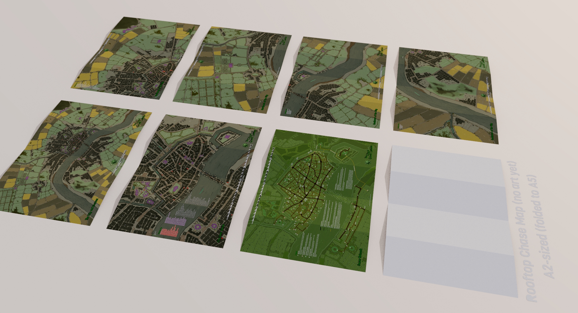
In this first image, all the maps to the bottom of the screen are front, and the ones to the top of the screen are reverses.

They are (BL-BR, then TL-TR):
- Full City Map (no annotations)
- Inner Wards Map (annotated)
- Sewer Network (annotated)
- Rooftop Chase (no art yet)
- Enlarged Full City map (NE) (annotated)
- Enlarged Full City map (NW) (annotated)
- Enlarged Full City map (SE) (annotated)
- Enlarged Full City map (SE) (annotated)
All these maps are A2 (folded to A5).
…and because the Enlarged Full City maps are on the reverse of all the other 4 maps, they can be assembled together to create an A0 map.

As an aside, this is a low-resolution version of the ward map that will go in the rear endpaper. It shows all the ward names, with a ward summary to the left:

Buildings
And here are all the current elevations done for the ‘detailed’ structures (18/20). I am so happy with how these have turned out.

Keep your eye out for the Kickstarter coming in Mid-march, and all this AND MORE can be yours.
PLEASE FEEL FREE TO SHARE THIS POST AND/OR THE IMAGES
(WITH ATTRIBUTION TO THIS POST).
#themidderlands #themidderlands3 #cityofgreatlunden #thecityofgreatlunden
And to Close… The Gateway to Hell
A couple of midderfolk pointed me to this Guardian article… I told you there were witches afoot!
“If there is a gateway to hell, a portal from the underworld used by demons and witches to wreak their evil havoc on humanity, then it could be in a small east Midlands cave handy for both the M1 and A60.”
https://www.theguardian.com/culture/2019/feb/15/nottinghamshire-cave-carvings-marks-scare-witches


These are amazing!
Truly awesome!